Mapping USA (January 31) This coming Saturday at 1pm CST I’ll be co-presenting in a workshop at Mapping USA, a free virtual conference organized by OpenStreetMap US. The workshop, Historical Mapping with OpenHistoricalMap, OldInsuranceMaps.net, and Yesterdays will feature demos from me, Jeff of OpenHistoricalMap, and (particularly excitingly) Jacob and Mike from the new project Yesterdays. We’ll be showing how all of these crowdsourced applications are interrelated, for example, how georeferenced maps OldInsuranceMaps.
READ MORE →
Also on Bluesky
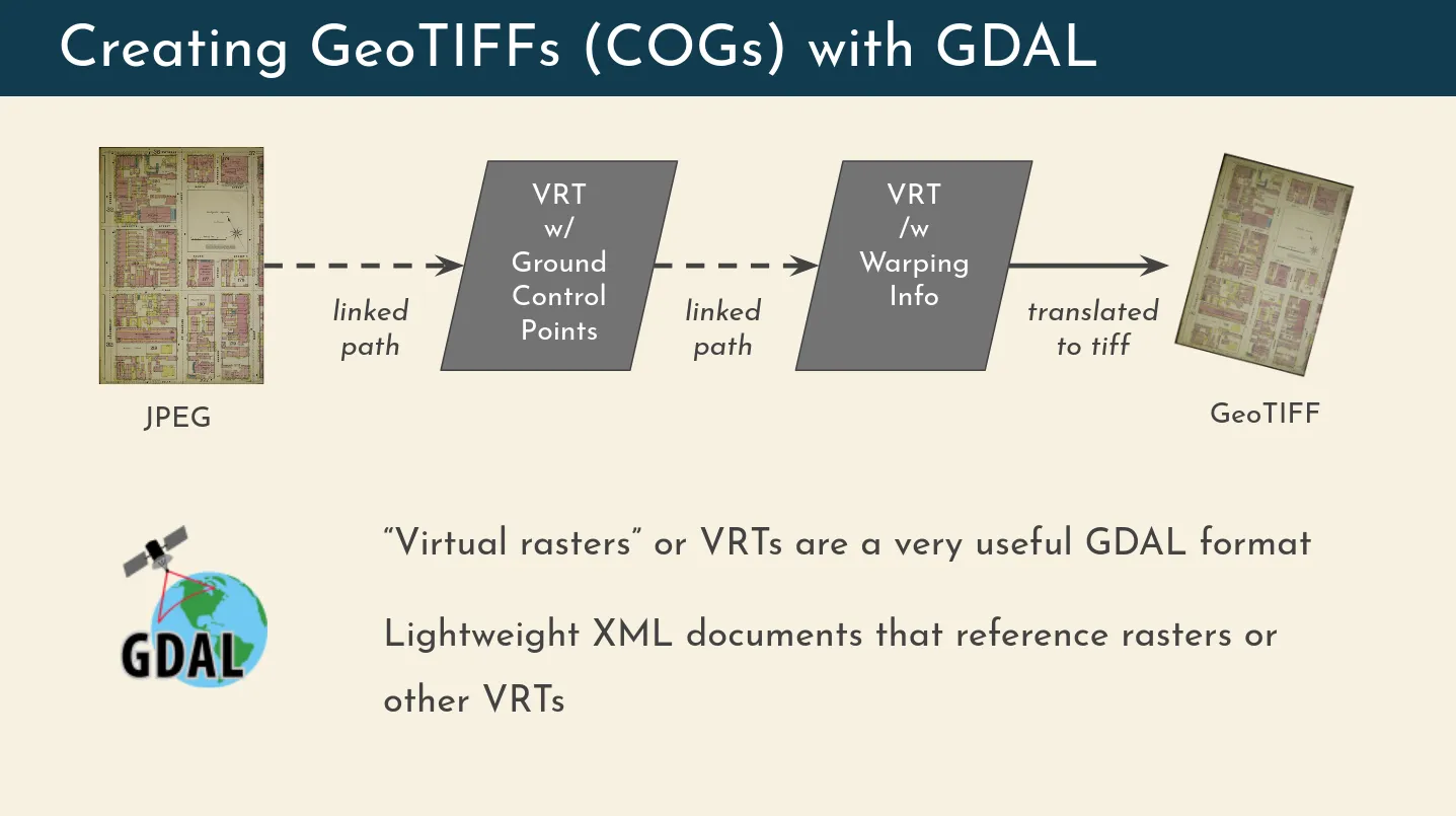
Recently I gave a presentation about OldInsuranceMaps.net for I-GUIDE’s Virtual Consulting Office speaker series and I was able to talk a bit more about the technical details of the platform than I have in the past, which was really fun and a great excuse to make some more diagrams. One element of the system I described is the way that the georeferencing process relies on GDAL’s “virtual raster” driver (i.e. file format), and how this is used for, among other things, the live preview feature of the georeferencing interface.
READ MORE →
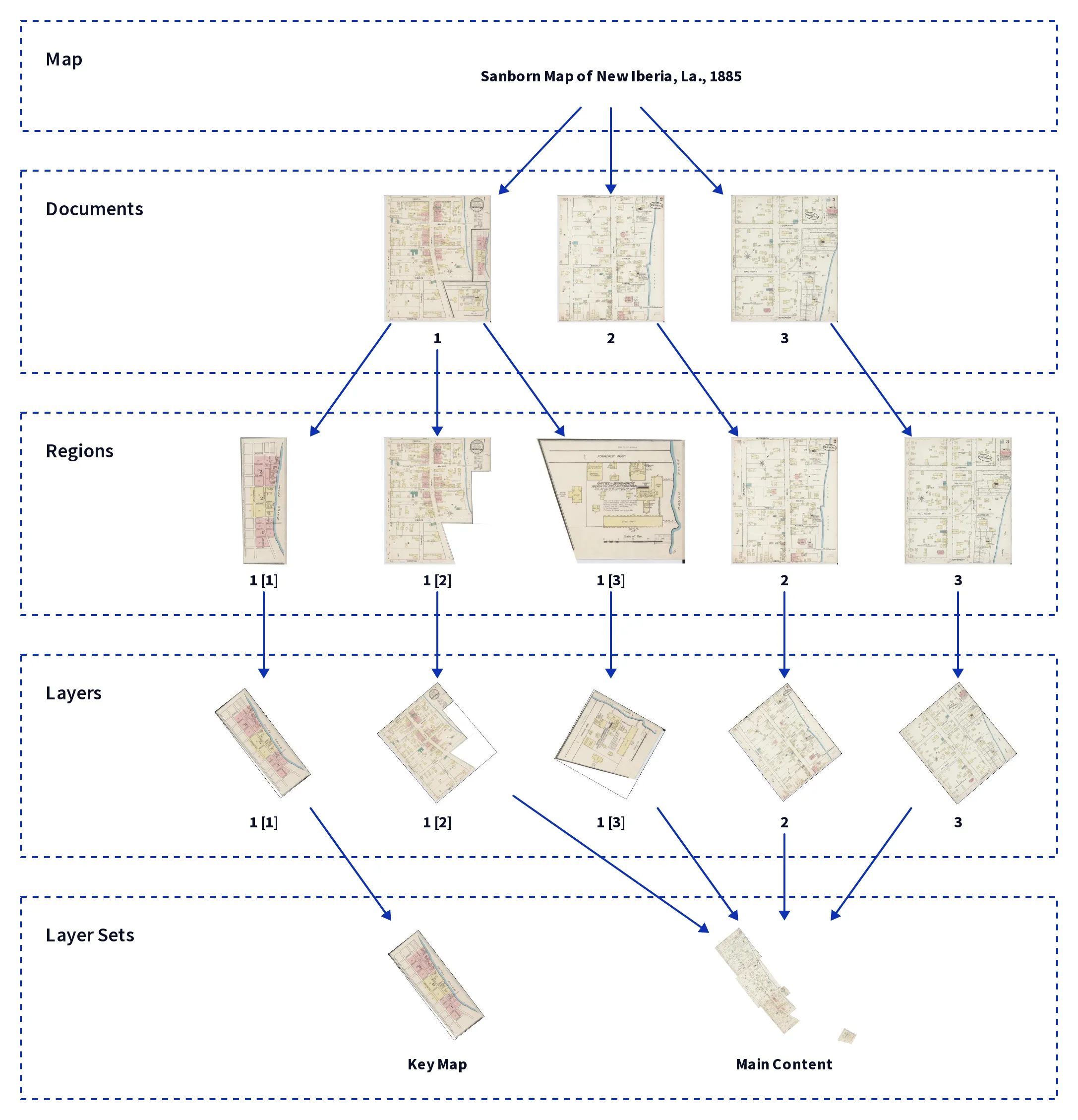
Last month I traveled to the annual North American Cartographic Information Society meeting, this year in Tacoma, WA, and presented about OldInsuranceMaps.net. The video of the talk is now on YouTube: Handling Complex Content within Georeferenced Historical Atlases. You can also flip through the slides here: tiny.cc/nacis2024-ac. Even though it sounds pretty boring, this was extremely gratifying to put together and present, because it distills what I think is most unique about the platform.
READ MORE →
In June I went to Richmond, Va. to present with Jeff Meyer from OpenHistoricalMap at the State of the Map US, an annual meeting for the OpenStreetMap US organization. It was a fantastic conference, and our presentation “Mapping the turn of the Century with OHM and OldInsuranceMaps.net” was really well-received. We demonstrated how people can georeference maps in OIM and then turn around and use them as basemap layers in OHM to digitize historical buildings and other features.
READ MORE →
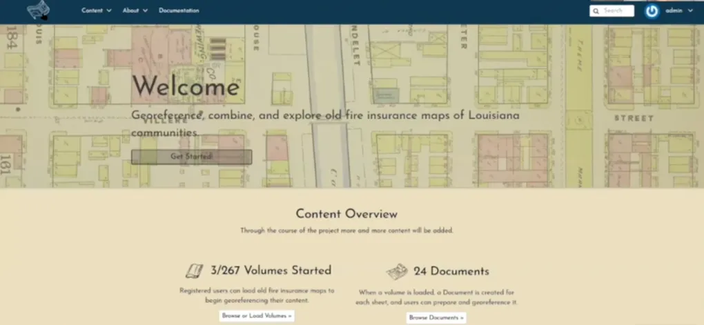
In October 2022 I attended NACIS Annual Meeting in Minneapolis and presented the results of the crowdsourced georeferencing pilot project I had carried out earlier that year. My presentation was titled Crowdsourced Georeferencing Sanborn Maps of Louisiana. The title is basically just an arbitrary rearrangement of words I’d used before, but the talk itself contains a lot of detail around how well the site worked for people, and discussion of how and why people participated.
READ MORE →
Today is the final day of the official public participation period of the project at oldinsurancemaps.net. My sincere gratitude to all of you, we’ve done a lot of great work! Tomorrow the unofficial participation period starts, where I can finally work on the content and…
READ MORE →
At the very beginning of the pilot project period, I was able to do a short remote presentation for the folks at Geo4Lib Camp 2022. No slides for this, it was just a live demo of the site which was about to go live for the public to use. It is probably the best demonstration of how the platform looked and worked through that period of time.
Checkout the video here on YouTube: https://www.
READ MORE →
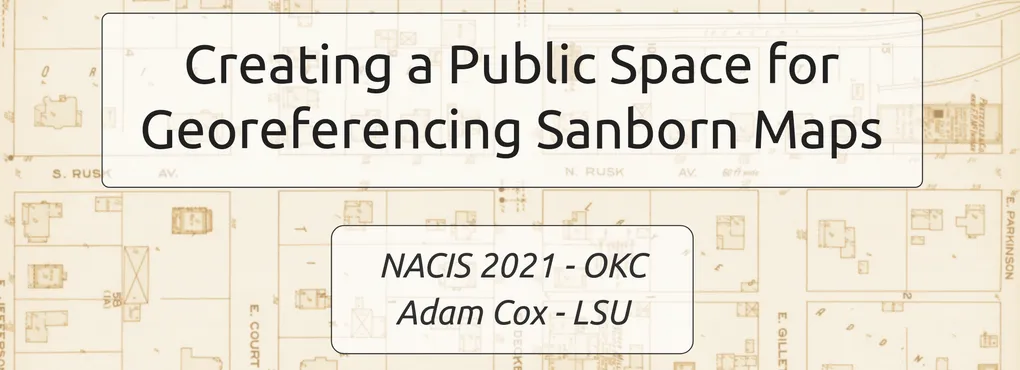
In October 2021 I attended my first (in-person) meeting of the North American Cartographic Information Society (NACIS), held that year in Oklahoma City. My presentation was titled Creating a Public Space for Georeferencing Sanborn Maps.
Abstract:
This talk will introduce my thesis work on an online map georeferencing platform tailored to the digital Sanborn Maps collection at the Library of Congress. My approach extends the open source geospatial content management system GeoNode to add a georeferencing interface that anyone can use.
READ MORE →
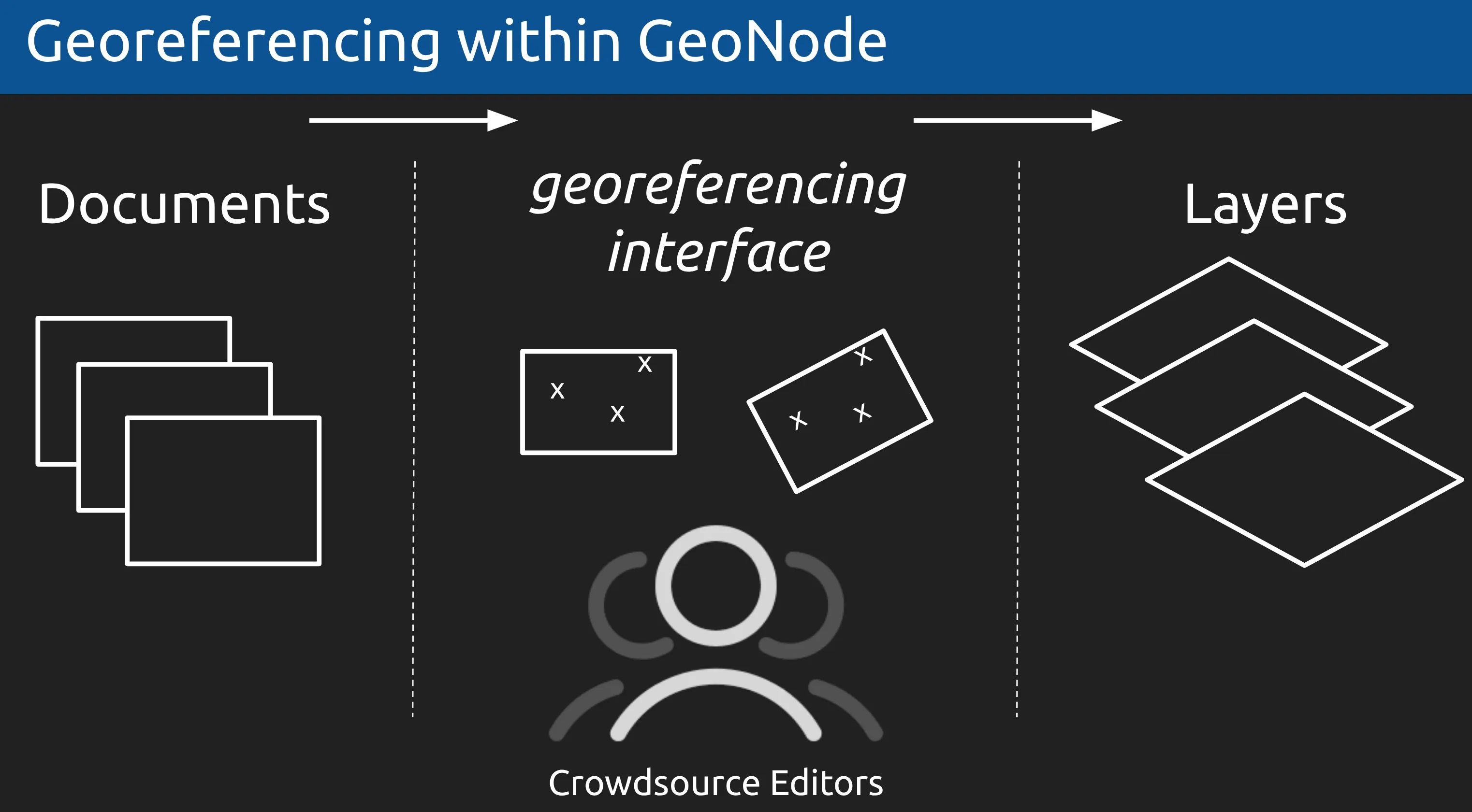
By December 2020 I had decided to build my georeferencing platform as an extension on top of GeoNode, a open source geospatial content management system. I was able to present my ideas about how and why this would work to the GeoNode community at the GeoNode Virtual Summit.
No recordings made for this talk, but here’s a link to the slides: Extending Geonode to Support Historical Map Georeferencing
READ MORE →