Last month I traveled to the annual North American Cartographic Information Society meeting, this year in Tacoma, WA, and presented about OldInsuranceMaps.net. The video of the talk is now on YouTube: Handling Complex Content within Georeferenced Historical Atlases. You can also flip through the slides here: tiny.cc/nacis2024-ac. Even though it sounds pretty boring, this was extremely gratifying to put together and present, because it distills what I think is most unique about the platform.
Abstract:
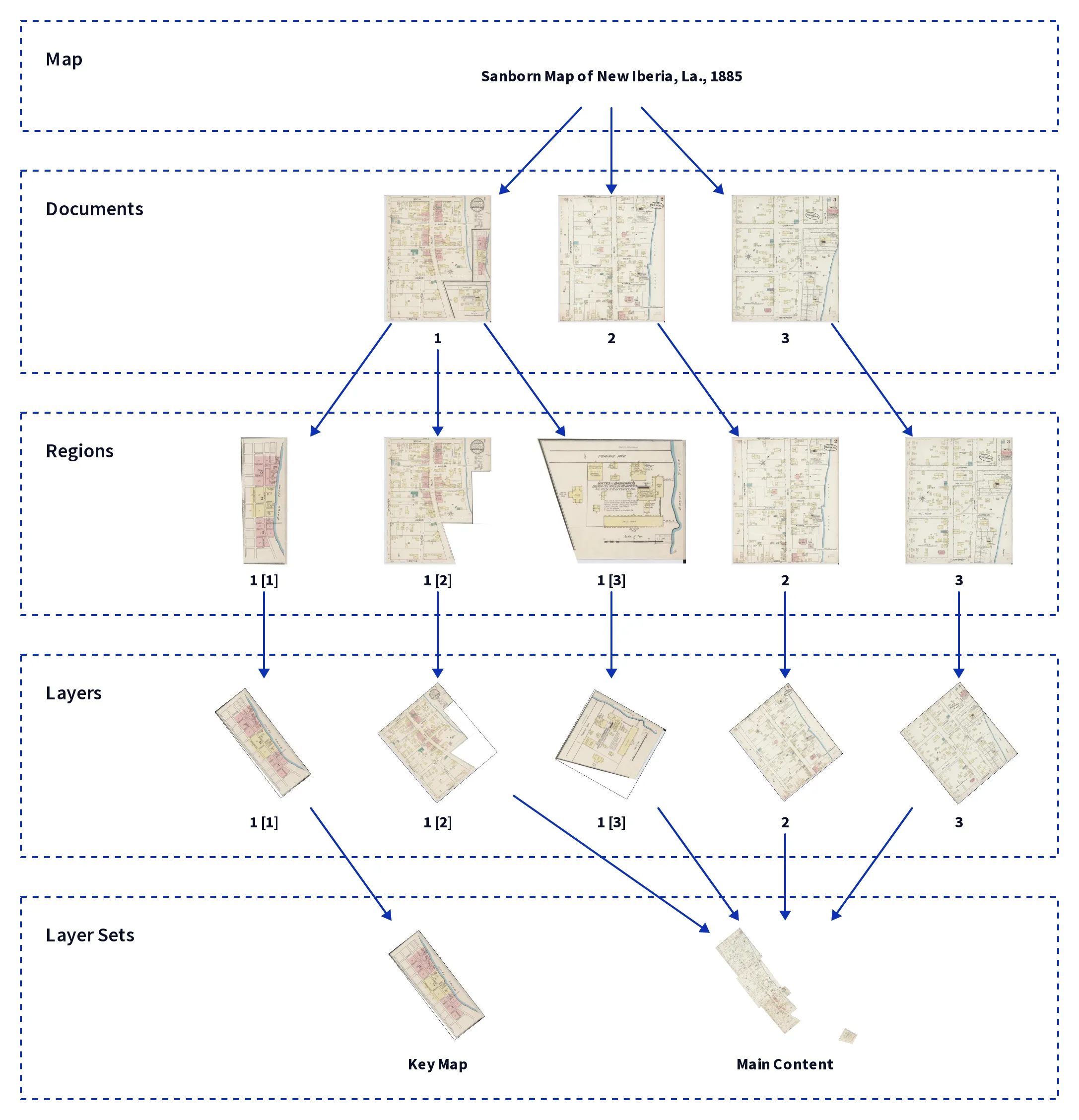
While georeferencing a single map is an easy one-off process, applying the work across a whole atlas (or multi-volume set) is a challenging task–especially when pages have multiple insets and the atlas contains more than one category of maps. How do you structure this work, and create cohesive output? This presentation will describe the novel hierarchical approach within OldInsuranceMaps.net, a crowdsourced web georeferencing platform designed around the complexities of Sanborn fire insurance maps. Facilitating the creation of seamless mosaics from this collection has resulted in a robust, abstract workflow that could be applied to any other maps or collections as well.
I made a bunch of diagrams for the presentation using d2, and here is my favorite one:
As a lucky bonus, Riley Champine from the URichmond DSL presented in the same session right after me, so I encourage you to watch his talk as well: Using Old Maps for New Insights on America’s Cities. He discusses updates to the lab’s Mapping Inequality project, and near the end has a fantastic demo of their new project Fires of Industry, that is based on the monumental georeferencing effort their students are carrying out using OldInsuranceMaps.net. I heard a few “wows” in the audience when he showed this.