Upcoming Georeferencing Events in New Orleans
Here in New Orleans we are looking forward to two georeferencing events coming right up! For the next two Tuesdays (May 5th & 12th) we’ll be partnering with HistoryForge to host georeference-a-thons at Second Line Brewing, just like we’ve done in the past; these will be our 7th and 8th events here!
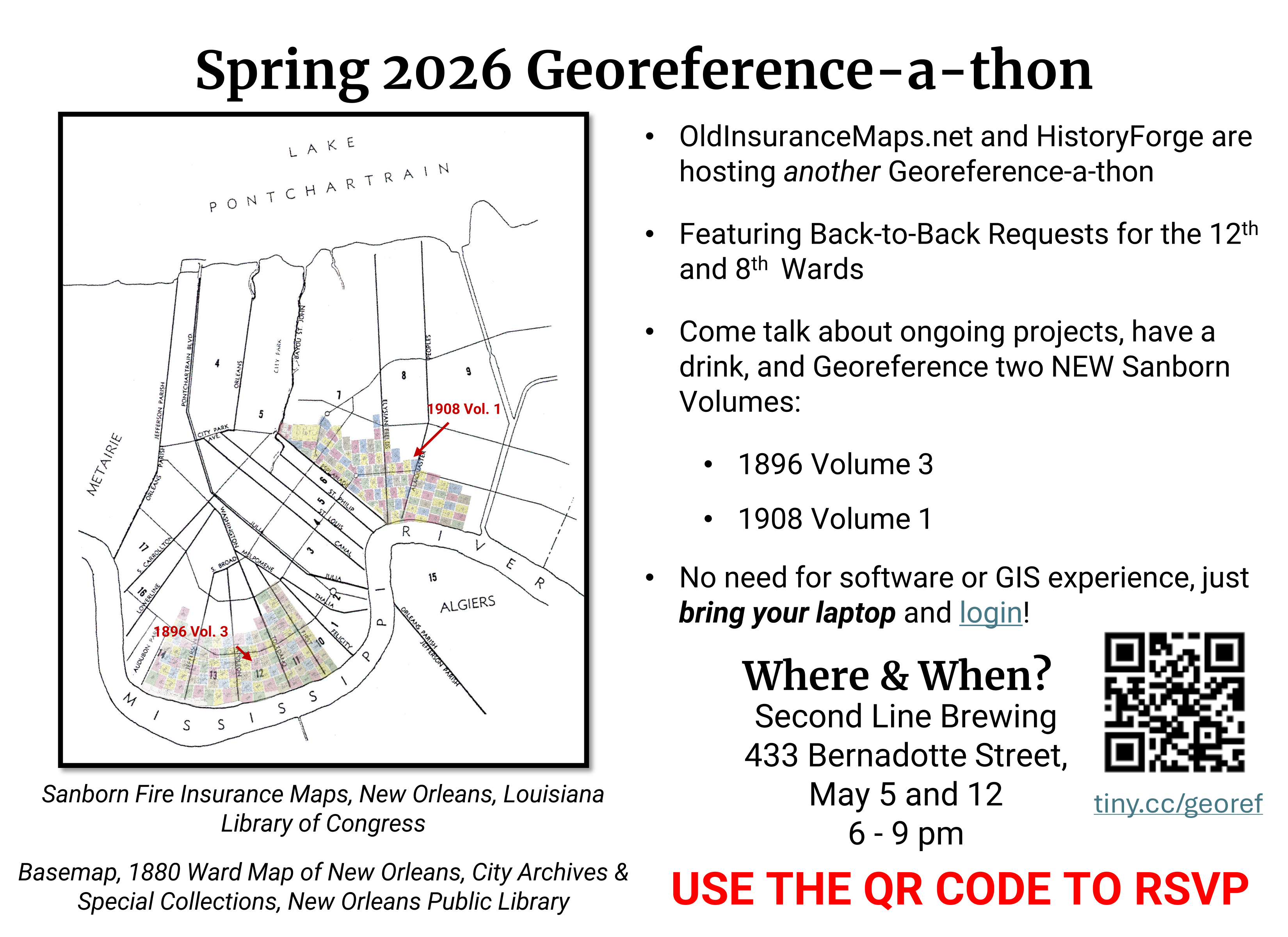
These are fairly informal gatherings, with an intro and demo at 6:30, and then socializing and georeferencing to follow. We also hope to have a short presentation about areas we’ll be working on (8th Ward and 12th Ward), though are still ironing out those details.
If you are in the area and would like to attend, please RSVP here: tiny.cc/georef looking forward to seeing some of you next week!
I’d also like to highlight a couple events that other groups have held recently.
Mapping Historical Duluth: A Crazy Long-Term Project You Can Contribute To
At University of Minnesota Duluth, Laure Charleux put together a public history workshop as part of the Twin Ports Festival of History. The event featured not only map georeferencing with OldInsuranceMaps.net, but also a historical photo tagging activity, which proved to be especially popular with attendees! Laure and her students are working on multiple digital history projects here: Duluth Historical GIS.
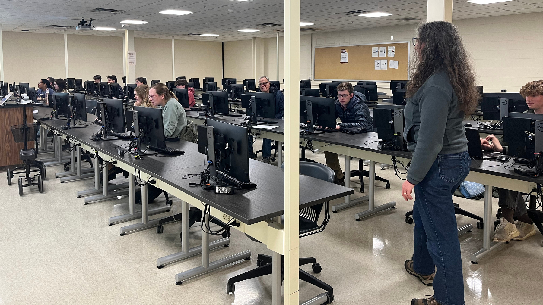
Engineering Open House at UIUC
Members of the Healthy Regions and Policies lab at University of Illinois, Urbana-Champaign put together a Friday evening map-a-thon as part of the Engineering Open House, 2026. Continuing to work on maps in their area, the group completed the Urbana 1909 atlas (almost 30 layers) as well as maps of some other small towns in the area. Thanks to Gabi, Anya, Marc, and especially Cat for putting this event together!
If you or your organization would like to use OldInsuranceMaps.net to facilitate an event, don’t hesitate to get in touch! I’ve also drafted a page describing these events in general. A comprehensive list of all past events is still in the works though…