Hello everyone, happy GIS Day! I hope you are celebrating appropriately.
This will be a quick newsletter, but it is the first since the announcement about OldInsuranceMaps.net joining OSM US, so we have a lot of new readers, 65 to be exact. Welcome! You can find the full newsletter archive going back to Feb 2022 on the blog.
An opportunity to talk about your georeferencing and research
The call for proposals is open until Nov. 22nd for Mapping USA 2027, an online conference held by OSM US. If you have 5-10 minutes of stories about your use of OldInsuranceMaps.net, we’d love to hear them! You can submit a proposal with this form
Georeference-a-thons: Past, Present, and Future
- Today, Jerry Shannon and the Community Mapping Lab at University of Georgia will be working on a georeferencing Columbia, Ga. Looking forward to hearing how it goes!
- Last week, the Healthy Regions & Policies Lab kicked off GIS and Geography Awareness week (a week in advance) with a night of georeferencing, working on Cairo, Ill. Looks like all it needs now is a multi-mask… any takers?
- In related news, the Louisiana Creole Research Association is hosting a HistoryForge event on Dec 5th led by our friends Elizabeth Williams and Jessica Dauterive from the Midlo Center. I recommend checking this out if you are able, it’s on Zoom! (more info at Louisiana Creole Research Association homepage).
Other news
- A shoutout to a new sponsor: Subterrix, a web platform and community for the metal detecting community.
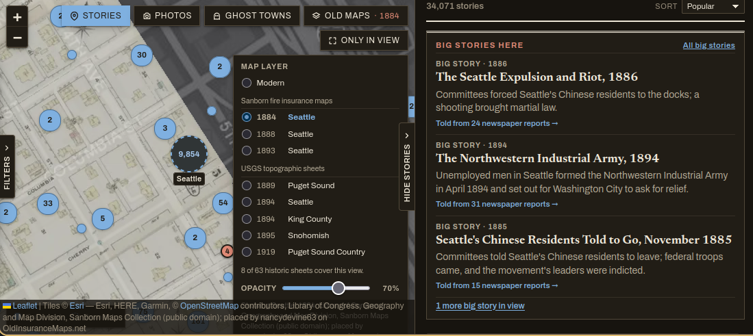
- A new website is using our maps! SameStreets puts historical newspaper articles about Washington on a map, and now you can add Sanborn reference layers source from OIM. Riley and I were exploring the site the other day and we love how they have added the usernames of anyone who georeferenced the maps you are looking at to the attributions (checkout the very the bottom of this screenshot).
- I wrote recently about how you can now trigger mosaicking jobs on maps that you loaded. This addition to the platform was funded through a partnership with Wayne State University Libraries, the Leventhal Map & Education Center, and the American Geographical Society Library. Thank you all for making this improvement to OIM possible!
That’s all for now! There is always too much to say and not enough time. We’ll be back next year with the next newsletter, and will have some very exciting news to share :)