Last November, Josh Sadvari and Michelle Hooper hosted a Georef-a-thon at The Ohio State University Libraries using OldInsuranceMaps.net, and wrote this detailed piece about how they prepared for the event, how the platform worked for them, and what kind of engagement their participants got from the experience.
Piloting a Sanborn Map Georef-a-thon for GIS Day 2023, WAML Information Bulletin, Western Association of Map Libraries. 2024. Josh Sadvari and Michelle Hooper
READ MORE →
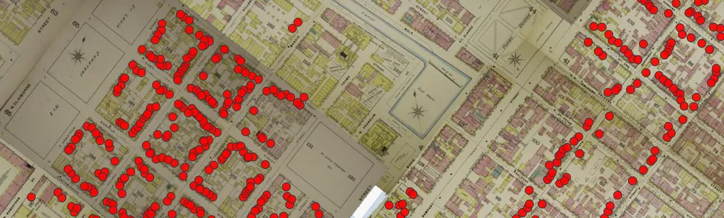
Working with the HistoryForge team we have gotten the mosaicked New Orleans 1895, vol. 1 edition into their web map interface! You can find it in the map overlays at https://sela.historyforge.net/forge. (Also admire the Robinson Atlas and other layers Elizabeth has added while you are there!) Some may recall this edition was the focus of our first georeference-a-thon this past summer. Happy to see it in use outside of OldInsuranceMaps.net! The best thing about this integration is that it spurred some development on the HF platform, so now any maps/mosaics from OldInsuranceMaps.
READ MORE →
In June I went to Richmond, Va. to present with Jeff Meyer from OpenHistoricalMap at the State of the Map US, an annual meeting for the OpenStreetMap US organization. It was a fantastic conference, and our presentation “Mapping the turn of the Century with OHM and OldInsuranceMaps.net” was really well-received. We demonstrated how people can georeference maps in OIM and then turn around and use them as basemap layers in OHM to digitize historical buildings and other features.
READ MORE →