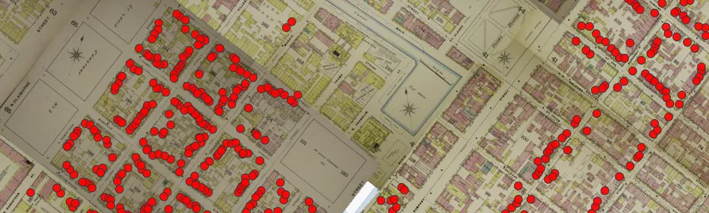
The “multimask” is a concept in OldInsuranceMaps.net that greatly eases the creation of seamless mosaics from many different georeferenced layers. I recently made some updates to the user interface for this tool, and decided to take the time to provide a better introduction to feature as a whole.
READ MORE →
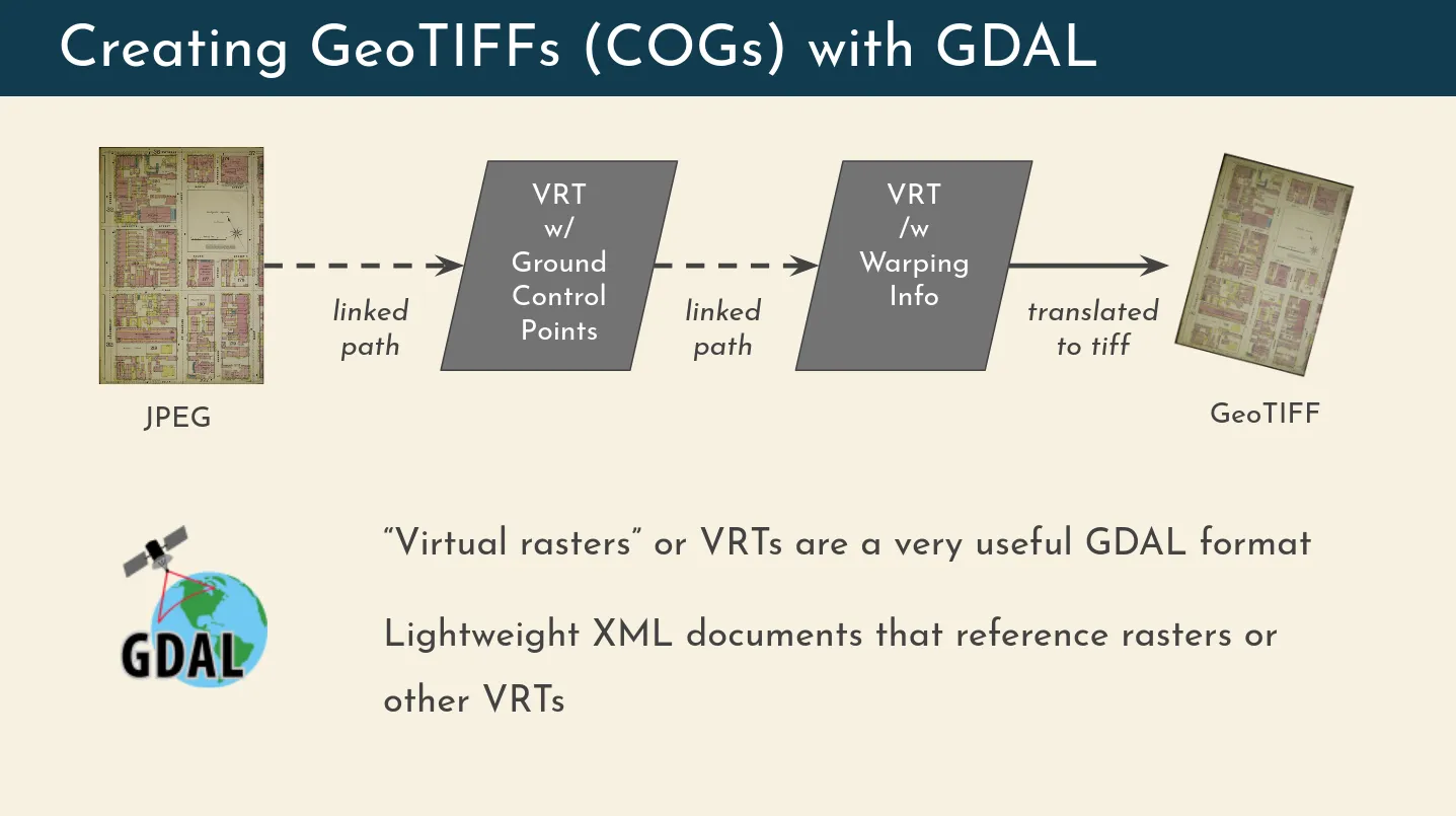
Recently I gave a presentation about OldInsuranceMaps.net for I-GUIDE’s Virtual Consulting Office speaker series and I was able to talk a bit more about the technical details of the platform than I have in the past, which was really fun and a great excuse to make some more diagrams. One element of the system I described is the way that the georeferencing process relies on GDAL’s “virtual raster” driver (i.e. file format), and how this is used for, among other things, the live preview feature of the georeferencing interface.
READ MORE →
What is S3 Object Storage? S3 object storage is a protocol developed by Amazon Web Services for handling file storage outside of a normal server environment and “in the cloud” instead. In other words, it’s a simplified way of uploading, downloading, or directly accessing files that are stored in remote “buckets”. In these buckets, storage is (broadly speaking) very cheap and practically unlimited. Many other companies have since adopted the S3 API so their own cloud storage offerings are compatible with it.
READ MORE →
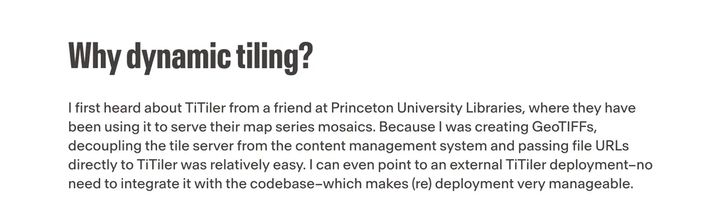
Working with Kiri and Sanjay from Development Seed, we put together this post for Dev Seed’s blog: Open Source Spotlight - Old Insurance Maps. This came about because Kiri saw my presentation at FOSS4G Southeast in Nashville last year, where I described how I had reworked OldInsuranceMaps.net to use TiTiler (open source software that Dev Seed created and maintains) for dynamic raster tiling, replacing GeoServer which had been incorporated into the platform from the beginning.
READ MORE →
Working with the HistoryForge team we have gotten the mosaicked New Orleans 1895, vol. 1 edition into their web map interface! You can find it in the map overlays at https://sela.historyforge.net/forge. (Also admire the Robinson Atlas and other layers Elizabeth has added while you are there!) Some may recall this edition was the focus of our first georeference-a-thon this past summer. Happy to see it in use outside of OldInsuranceMaps.net! The best thing about this integration is that it spurred some development on the HF platform, so now any maps/mosaics from OldInsuranceMaps.
READ MORE →
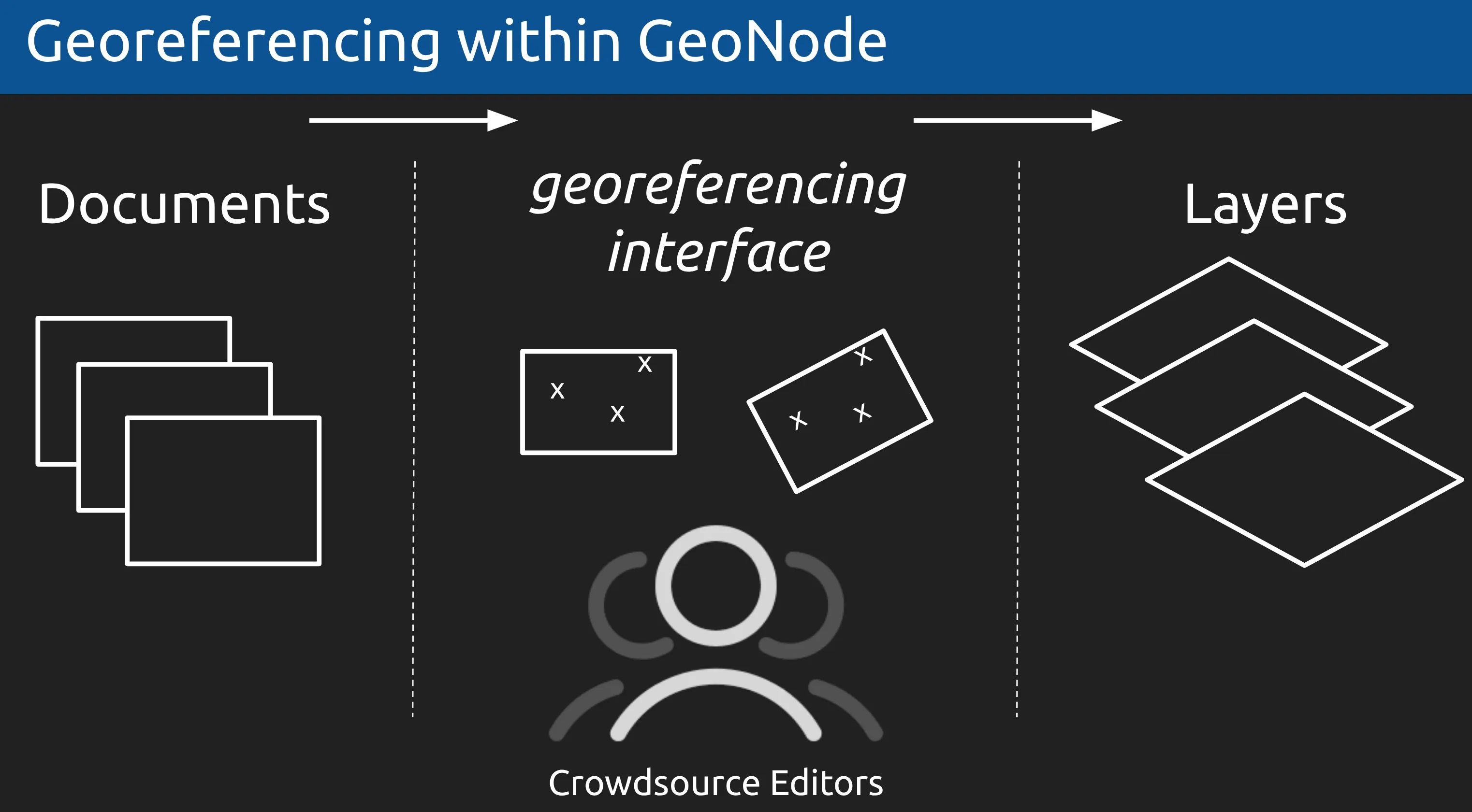
By December 2020 I had decided to build my georeferencing platform as an extension on top of GeoNode, a open source geospatial content management system. I was able to present my ideas about how and why this would work to the GeoNode community at the GeoNode Virtual Summit.
No recordings made for this talk, but here’s a link to the slides: Extending Geonode to Support Historical Map Georeferencing
READ MORE →